
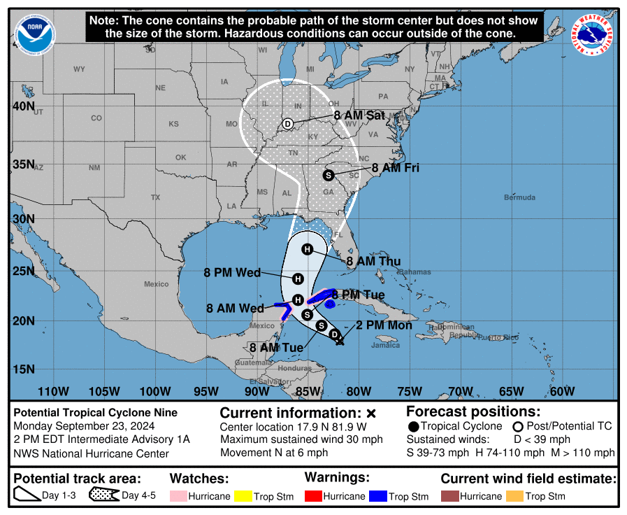
A hurricane could make landfall in Florida later this week, the National Hurricane Center has warned. National Hurricane Center forecasts are currently calling the weather system “Potential Tropical Cyclone Nine,” but expect it to form into a hurricane, dubbed “Hurricane Helene,” over the course of the week.
Tropical storm conditions, and potentially hurricane conditions, are anticipated over parts of western Cuba and the northeastern coast of the Yucatan Peninsula on Tuesday night.
[time-brightcove not-tgx=”true”]
The storm is then expected to intensify and become a major hurricane, potentially a category 3, by Thursday, when it reaches the northeastern Gulf Coast. As of Monday morning, forecasts predicted that the hurricane will make landfall along the Florida Panhandle sometime Thursday. Tropical storm warnings and hurricane watches have been issued for portions of Mexico and Cuba.
The National Hurricane Center said Monday that there is “an increasing risk of life-threatening storm surge and damaging hurricane-force winds” along portions of the northern and northeastern Gulf Coast—which includes the Florida Panhandle and portions of Florida’s west coast.
As of Monday morning, the National Weather Service said that it was too soon to specify the exact location of the storm and magnitude of impact, but urged residents in its path to monitor forecasts and ensure they have a hurricane plan in place. Gov. Ron DeSantis declared a state of emergency for 41 out of 67 counties in Florida on Monday ahead of the expected weather.
The storm could become the fourth hurricane to make landfall in the U.S. this year, as extreme weather events are expected to become more common due to warming temperatures in the Gulf of Mexico. The last time four or more hurricanes landed in the U.S. during hurricane season was in 2020, the most active hurricane season on record, according to Climate.gov.