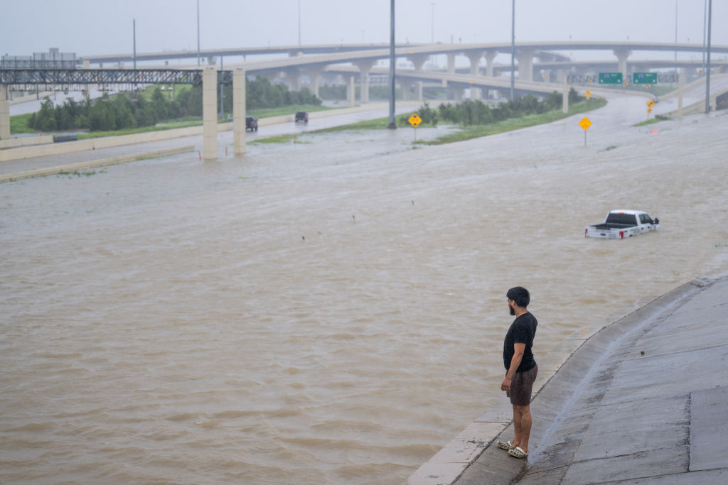
On Wednesday evening, Hurricane Milton will become the fifth hurricane in 2024 to make landfall in the mainland U.S. As storms like this one grow more frequent and intense, artificial intelligence is playing an increasingly central role in efforts by meteorologists and other scientists to track these storms and mitigate their harms.
For years, meteorologists have built complex forecasting models of storms based on wind speeds, temperature, humidity and other factors, and recorded via readings from planes, buoys and satellites. But these models can take hours to produce updated forecasts.
[time-brightcove not-tgx=”true”]
Machine learning models, on the other hand, draw upon vast knowledge of the earth’s atmosphere and data from how previous storms have unfolded. They excel at pattern recognition, teasing out trends that most humans can’t discern in a fraction of the time. And this year, they have repeatedly offered accurate storm-related predictions, generated within seconds, and days in advance of a storm hitting a coast.
“The meteorology community is, in some cases reluctantly, and in some cases fully embracing, AI modeling,” says the Houston-based meteorologist Matt Lanza. “In terms of hurricanes, we’ve learned that the AI modeling can go toe-to-toe with the physics-based model, so you have to use it.”
Read More: Here’s What You Need to Know About Hurricane Milton’s Expected Path
Lanza says that this week, a consensus has emerged among many different types of models that Milton will probably land between Clearwater and Sarasota, Florida. AI modeling, Lanza says, “probably picked up on that potential outcome a good 12 to 18 hours before a lot of the other modeling.”
AI’s accuracy tracking storms
This isn’t the first time that AI models have predicted a hurricane’s path this year before traditional models. GraphCast, created by the Google AI company Deepmind, trained an AI program on four decades of global weather data, and correctly predicted that Beryl, the first major Atlantic hurricane in 2024, would make landfall in Texas, as opposed to a top European model predicting a Mexican landfall. The team behind the project won Britain’s top engineering prize this year, with one of the judges calling it “a revolutionary advance.”
A couple months later, a European AI model called AIFS successfully predicted the path of Francine as it hit the Gulf Coast. “The consistency was incredible,” Lanza says. “Even the best performing traditional models I don’t believe were this consistent.” Lanza wrote on his blog that the model’s accuracy gave his team confidence that the storm would not be a major concern for Texas, which allowed people on the ground to plan and marshall resources more appropriately.
Other major forecasting models include FourCastNet, developed by NVIDIA, and Pangu-Weather, from Huawei. The National Hurricane Center (NHC), for its part, has integrated AI in its forecasting processes, with NHC Deputy Director Jamie Rhome calling it a “pillar” of success last year. “The sophistication of AI has dramatically improved and it continues to improve, and that’s critical because we only have three hours to make the forecast,” he told NBC Miami.
Despite its success, the technology still has plenty of hiccups. A 2024 study found that while machine learning models effectively forecasted large-scale features of the European windstorm Ciarán, they failed to register damaging surface winds and other unusual aspects of the storm. Lanza says that AI models tend to underestimate the intensity of hurricanes and sometimes struggle with gauging precipitation.
Because of these errors, Lanza says it’s crucial for meteorologists not to solely rely on AI forecasting. “We’re not turning the reins over to these things and just saying, ‘make me a forecast and I’ll just regurgitate it,’” he says. “You have to still look at the broader spectrum of tools available to you.”
Predicting storm surge
At the University of Florida, AI scientist Zhe Jiang is working to solve one of these more granular problems in accuracy: how storm surges will affect Florida’s coasts. Jiang says that AI for coastal modeling has lagged behind more global weather forecasting, due to the lack of high-quality training data and the fact that data-driven neural networks are often unaware of fundamental physical principles, like how water will move or disperse.
To move this field forward, Jiang and his colleagues, including coastal oceanographers, have been training an AI surrogate based on coastal simulations. According to preliminary results, this AI has created forecasts for ocean currents 500 times faster than previous models. Jiang hopes to train the model for storm surges soon, which he hopes could save lives and prevent property damage. “In current forecasting, it may take a few hours to make a forecast. If we reduce the time to seconds, disaster managers can plan more time ahead and have more people better plan for the potential damage,” Jiang says.
But Jiang is careful to note that simply using general-purpose AI models to predict storm surges could have disastrous consequences. “Neural networks sometimes make over-confident but inaccurate predictions, causing severe consequences in high-stake decision-making,” he says.
Many other researchers have embarked on parallel projects. A researcher at the University of Miami is training computers in the hopes of building 3D replicas of active storm systems, so that planes don’t have to fly into them to take readings. Another company is using machine learning to try to predict where power outages will happen, and how many residents may be affected.
Jiang says facing hurricanes like Milton makes his work all the more urgent: “There are more and more severe events and coastal hazards like Hurricane Milton going on near my home, and we are really racing with time to develop AI technologies faster.”

