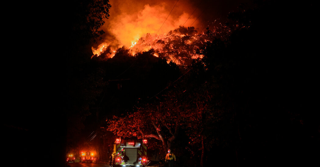
Winds picked up again early on Sunday across Southern California, reaching close to 70 miles an hour near the western and eastern San Gabriel Mountains and the Highway 14 corridor.
By the afternoon the winds are forecast to ease for a while, giving firefighters a reprieve to battle devastating wildfires. But that reprieve might not last long, forecasters say, as another round of strong, gusty Santa Ana winds develops on Monday and Tuesday, contributing to another stretch of dangerous and potentially extreme fire conditions.
Brian Hurley, a meteorologist with the Weather Prediction Center of the National Weather Service, cautioned that while the winds this week may not be quite as strong as they were last week, their long duration could make the fire risk worse, especially in the western Los Angeles basin and Southern Californian mountains.
With the humidity remaining low and the vegetation in the region very dry, an upgrade to “extreme” fire conditions, the highest risk classification, is “very well on the table,” Mr. Hurley said. Conditions were rated extreme last week, when wind gusts reached 100 m.p.h.
For now, though, the fire risk is expected to be one level lower, at “critical,” in parts of Southern California from Sunday afternoon to Tuesday afternoon.
The National Weather Service office in Los Angeles forecasts that the stronger Santa Ana winds will last from Monday night into Wednesday. Andrew Rorke, a meteorologist with the Weather Service, said the winds were expected to follow the typical Santa Ana direction, blowing northeast to southwest.
The areas with the strongest winds will stretch from the mountains northeast of the Santa Clarita Valley, through the valleys along the Ventura and Los Angeles county line, and out across the western Santa Monica Mountains.
They will be most powerful in the mountains, with gusts up to 60 m.p.h. Areas at lower elevations like San Clarita Valley and parts of Los Angeles and Ventura Counties will experience wind gusts between 35 m.p.h. and 55 m.p.h.
“The only good news here is that the San Gabriel foothills and Eaton Fire area will not see any strong winds from this event,” Mr. Rorke said.
Looking ahead, forecasters predict that the winds will continue into Thursday, but be weaker than on Wednesday, and may fall below the levels at which they would prompt a fire risk advisory. This will also lower temperatures in valleys and along the coast.
By Friday, a dry weather system will move east, and the winds will shift to blowing onshore from the ocean, dropping temperatures a little further.
One glimmer of hope, Mr. Hurley said, is a break from the extreme fire danger later in the week, when increased humidity is expected along with the lighter winds.
“There’s a very small chance of rain next weekend, but that’s going out a bit, and it’s not a whole lot of rain in the forecast,” he said.
Checkout latest world news below links :
World News || Latest News || U.S. News
The post Stronger Santa Ana Winds to Return, With ‘Extreme’ Upgrade Possible appeared first on WorldNewsEra.

