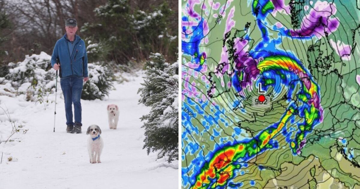
Snow, rain and strong winds are forecast to slam large parts of the country before January is out according to new weather maps.
Days may be gradually getting longer with the mercury gradually inching up but the UK’s winter isn’t over yet.
A fresh flurry of icy weather is set to move across the country on Saturday, January 25, according to forecasts from WXCharts, accompanied by low temperatures and stormy rain clouds.
The blitz of chilly seasonal conditions will begin to set in around midnight on January 24, initially impacting central Scottish regions the worst, with snow depths of around 2cm quickly accumulating.
Air moving in from the south west will bring heavy rain across England at around the same time, falling at an estimated 3 to 5mm each hour and especially concentrated on the eastern coastline.
By 6am, weather maps show half of the UK painted purple, with the snowy blanket stretched all the way across Scotland and Yorkshire into the East Midlands.
Depths could also reach 2cm in central England early in the morning, with Wales also coming in for a battering and the Northern Ireland coast not exempt from a few snow flurries.
While regions near the southern coast may dodge the latest blitz of wintry weather and all the disruption that comes with it, parts of the south east are set to be drenched by rain fall spreading across the English Channel to France and the Netherlands.
The snowy spell could be washed away by more widespread rain from the north east just a few hours later, however, with snow lingering in parts of Scotland but largely vanishing from across England by midday on January 25.
Despite the mercury beginning to climb back after an unprecedented cold start to 2025, weather related travel disruption is continuing to persist across the country with a yellow alert for fog risking flight delays and cancellations this morning.
Met Office meteorologist Clare Nasir said: “The issue will be over the next few days, fog, as well as some pockets of frost … where we see clearer skies.”
She added that clouds were expected to gather all the way across the Midlands, East Anglia and the south east throughout the day.
The weather expert said: “We’ll see probably some pockets of frost, so temperatures dipping close to freezing, if not below, and again, with a lighter breeze, fog will re-form anywhere from central and southern parts of England and Wales down towards the west country.”
The Met Office’s long range forecast for January 20 to 29 predicts wet and windy conditions growing in prominence towards the end of the month, with a southeasterly wind also ushering in risks of increasingly colder temperatures and snow showers.
Today:
Light rain and winds in northern Scotland with clouds and sunny spells for most of England. Dense fog clearing slowly throughout the day.
Tonight:
Rain showers in Scotland beginning to move across the south, as clouds from southern areas start to impact northern regions. Temperatures slightly milder with less fog.
Friday:
Brighter and drier weather expected in northern and western Scotland. Clouds persisting in southeast England and temperatures cooling off again across most of the UK.
Outlook for Saturday to Monday:
Clouds forecast across central and southern England with wind and rain in the northwest. Hill fog and occasional showers in Wales, with the mercury dipping in the south and rising in the north.
Checkout latest world news below links :
World News || Latest News || U.S. News
The post UK weather maps show giant wall of snow covering half of Britain appeared first on WorldNewsEra.

