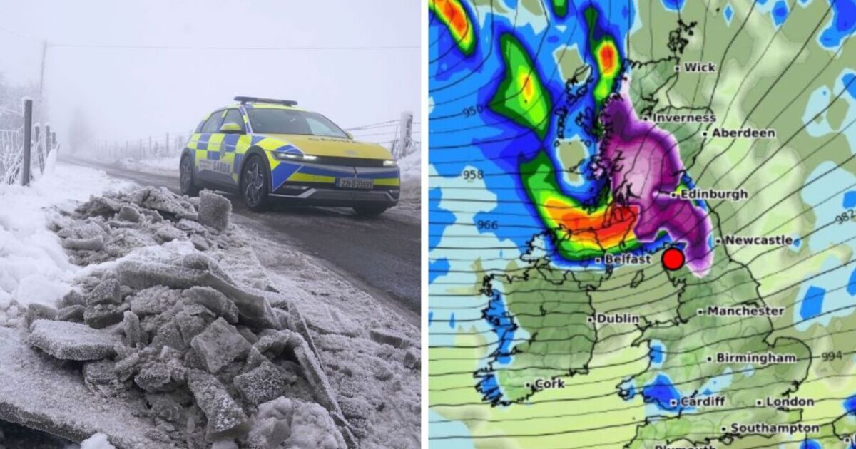
A fresh wave of wintry weather could hit a huge stretch of the UK in just a few days, and cold air from Scotland creeps into northern English regions.
According to forecaster WXCharts, the next blitz of potentially disruptive snow and ice moving in from the northwest could begin at midnight on January 28.
It would see snow depths rise to around 14cm in the Scottish Highlands and Loch Ness and Fort William and bring a torrent of seasonal flurries to the northeast, north-west and North Yorkshire, with Newcastle, Carlisle, Middlesbrough and Blackpool at risk of accelerated snowfall.
Snow is expected to continue falling across the roughly 393-mile UK stretch the following day, setting in northwestern England and pummelling the Irish Sea coast.
The fresh spell of wintry weather will push through Scotland, with the mercury hovering around 0C and lows of 1C in northern England.
By 6pm on January 28, the bulk of snowfall will be concentrated in central Scotland and the Highlands area, with the blanket settled down to around Northallerton in Yorkshire beginning to be swept out by rain showers moving in from the east.
The late January snowstorm follows a decidedly chilly and white start to the year, with weather-related disruption earlier this month grounding flights and disrupting road and rail travel.
The UK also recorded its coldest January night in 15 years, with temperatures dropping to -18.9C overnight in Altnaharra in Scotland on January 11.
Accompanying wet and windy forecasts also spurred the Environment Agency to issue flood warnings and alerts for most of the country at the beginning of 2025, with only 16 in place as of 7:30am on January 17.
While temperatures have returned to their monthly average of up to 7C in England, the Met Office has warned that more turbulent patterns could be in store before the end of January.
At the end of next week, the forecaster has warned of “much wetter and windier weather [becoming] prevalent from northwest to southeast” accompanied by a chilly, southeasterly wind.
“There is a small chance … that winds could turn much more easterly and colder, bringing the risk of snow showers,” a spokesperson concluded.
Today:
Pathy rain and clouds across Scotland and Northern Ireland. It will be chilly and breezy for most of England but expected to stay dry.
Tonight:
Rain and wind will continue in northern Scotland overnight and clear early tomorrow morning. Patchy frosts and cloudy spells in some areas.
Saturday:
Most of the country experiences dry and cloudy conditions, with some sunshine in the north and west. Temperatures are becoming milder in northern regions and cooler in the south.
Outlook for Sunday to Tuesday:
Chilly temperatures and cloudy conditions on Sunday, with western regions seeing some rainfall late in the day. The trend of scattered rainfall and clouds will continue throughout next week, moving in an erratic pattern southwards.
Checkout latest world news below links :
World News || Latest News || U.S. News
The post UK weather maps show the day 393-mile snow wall will wallop Britain appeared first on WorldNewsEra.

