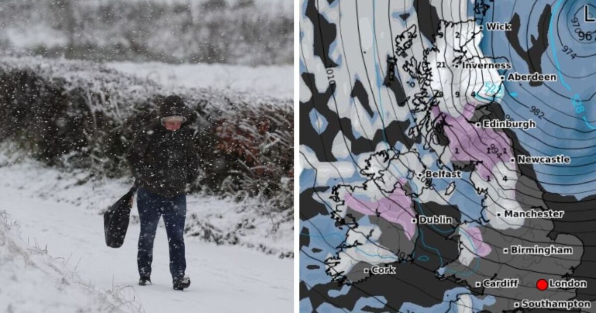
Partygoers hitting the town on New Year’s Eve may want to pack a jacket and scarf, as parts of the country are set to be hit by a snowstorm reaching from northern Scotland all the way down to Devon in the south.
New weather maps from WXCharts show a huge snowy blizzard, signified by a blanket of purple and white, covering most of northern England from 12pm on December 31.
Almost all of Scotland will be covered in white, according to the forecast, with around 3cm of snow falling each hour by midday and depths of up to 10cm by the evening.
Northern cities including Newcastle, Manchester, Carlisle and York will also see flurries throughout the day, with between 1cm and 5cm of snow accumulating by 6pm.
The wintry blitz is set to wreak havoc on party plans right across the country’s northern regions, coating parts of Northern Ireland including Belfast in snowfall and falling at around 0.5cm per hour as far down as Plymouth.
It will hit people across the UK just hours before temperatures could plunge to as low as -10C in central Scotland at around 6am on January 2.
Temperatures might not rise above -1C elsewhere in the UK on December 31, with southern regions including London, Birmingham and Southampton unlikely to see snow but positioned to get a strong dose of seasonal weather nonetheless.
The south west coast will also be drenched in rain throughout the day, with revellers in Devon running the risk of having the weather dampen their plans.
Areas around Belfast could also see rainfall of up to 1mm per hour between 12pm and 6pm.
High winds are also on the cards, potentially hampering travel plans after 75mph gust forecasts are posed to cause travel chaos over Christmas, with Heathrow Airport grounding 100 flights on December 22 amid the bad weather.
The Met Office’s long-range forecast for December 26 to January 4 predicts rain and strong winds in northwest Scotland, with some drizzle and clouds elsewhere and cooler temperatures heading into the new year.
Weather expert Jim Dale, a senior meteorologist and founder of British Weather Services, told Express.co.uk that people going out for New Year’s Eve should “keep their fingers on the pulse” amid potentially “severe wind and snow”.
He added: “It’s an early warning that we could well be in for some hazardous weather to bring in 2025.”
Today:
Gales expected across the UK, becoming more severe in the north and west. Showers arriving from the northwest with hail and snow. Temperatures remaining cold with some sunny spells.
Tonight:
Winds began to lessen and showers moving towards the east coast. Slight frost overnight with clear spells.
Monday:
Cold and sunny in the east with some rain and low clouds in the west. Temperatures growing milder.
Outlook for Tuesday to Thursday:
Mild temperatures and clouds forecast for the Christmas period. Weather staying wet and windy across northwest Scotland.
Checkout latest world news below links :
World News || Latest News || U.S. News
The post UK snow forecast as maps show 900-mile snowstorm hours before brutal -10C blast appeared first on WorldNewsEra.

