
The forecast remains cold and quiet for the rest of the week. We keep our clear skies overnight and that will allow temperatures to fall off once again. We might salvage a few degrees on top of this morning’s lows, but we’ll still fall to near 20° by sunrise tomorrow.
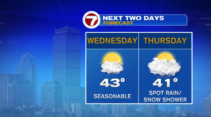
Tomorrow is similar to today with a few extra clouds in the mix. We continue to increase the clouds on Thursday and with that a widely isolated rain or snow shower possible.
The storm moving through from the Great Lakes, responsible for the few showers will eventually be the big player in our weekend storm potential. It’s less about the “L” itself and more about that cold front coming along with it. That cold front will open the door for cold air to move in and set up shop Friday, Saturday, and Sunday. Of course with our next system running into that cold air… snow lovers rejoice, it looks like our first real snow of the season!
I say this regarding our next storm with the disclaimer that this storm is still five days out and things are bound to change. But here’s a few notes on what we’d expect if there were zero changes between now and Sunday:
-Snow: This looks to be all or mostly snow. The rain/snow line is hugging the coast line and just a few miles off the water will be snow. The rain/snow ribbon is also hugging the Cape. I’d expect a flip back and forth there. But with any northward movement in the track of the storm, the rain/snow mix becomes more common across the area.
-For those that do see snow/all snow, it will absolutely be a plowable snow. So while we can’t give you a number yet, you will be shoveling this one.
-Rain is possible mainly on the coast line, but even there it won’t likely stay rain the ENTIRE storm so you’ll still see some snow. The question is how long can it hang on before it flips to snow. Of course this then affects the totals.
-Wind: While it will get windy on the coast, right now the bulk of the wind, and concerning wind is offshore. Again, a shift north with the storm track then puts more of the damaging wind potential at play. We’ll need to watch that.
-Coastal Flooding: Coastal concerns are low with this one as even the high tides are about three feet below astronomical high tides. Meaning we’d need a 3 foot storm surge just to pull us to what a naturally high, high tide is, plus additional on top of that which would lead to the flooding.
Checkout latest world news below links :
World News || Latest News || U.S. News
The post Quiet Week, Weekend Storm – Boston News, Weather, Sports | WHDH 7News appeared first on WorldNewsEra.